
Make a donation
Gear up for your next adventure:
As an Amazon Associate, this site earns from qualifying purchases at no extra cost to you.
Manjeri topographic map
Click on the map to display elevation.
Make a donation
Gear up for your next adventure:
As an Amazon Associate, this site earns from qualifying purchases at no extra cost to you.
Manjeri
Manjeri is located at 11°07′N 76°07′E / 11.12°N 76.12°E / 11.12; 76.12. It has an average elevation of 38 metres (124 feet) from sea level.
Make a donation
Gear up for your next adventure:
As an Amazon Associate, this site earns from qualifying purchases at no extra cost to you.
About this map
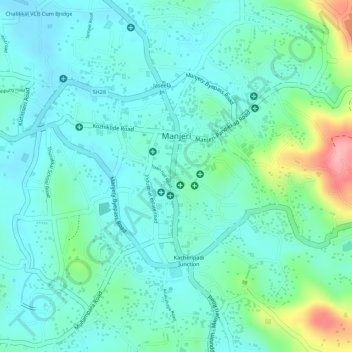
Name: Manjeri topographic map, elevation, terrain.
Location: Manjeri, Ernad, Malappuram District, Kerala, 676121, India (11.10677 76.11085 11.12734 76.13068)
Average elevation: 190 ft
Minimum elevation: 85 ft
Maximum elevation: 518 ft
Make a donation
Gear up for your next adventure:
As an Amazon Associate, this site earns from qualifying purchases at no extra cost to you.