
Sidhpur topographic map
Interactive map
Click on the map to display elevation.
About this map
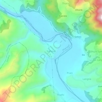
Name: Sidhpur topographic map, elevation, terrain.
Location: Sidhpur, Dharmpur, Mandi, Himachal Pradesh, 175051, India (31.82870 76.72962 31.86870 76.76962)
Average elevation: 2,365 ft
Minimum elevation: 1,932 ft
Maximum elevation: 3,809 ft
Other topographic maps
Click on a map to view its topography, its elevation and its terrain.
Banal
India > Himachal Pradesh > Dharmpur > Dharmpur
Banal, Dharmpur, Mandi, Himachal Pradesh, 175040, India
Average elevation: 2,713 ft