
Ratos topographic map
Interactive map
Click on the map to display elevation.
About this map
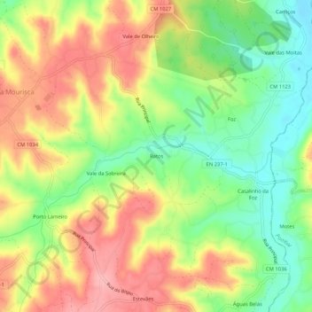
Name: Ratos topographic map, elevation, terrain.
Location: Ratos, Guia, Ilha e Mata Mourisca, Pombal, Leiria, Portugal (39.92271 -8.74960 39.96271 -8.70960)
Average elevation: 276 ft
Minimum elevation: 82 ft
Maximum elevation: 469 ft
Other topographic maps
Click on a map to view its topography, its elevation and its terrain.