
Kanke Dam topographic map
Interactive map
Click on the map to display elevation.
About this map
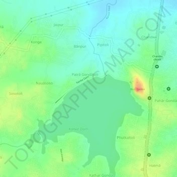
Name: Kanke Dam topographic map, elevation, terrain.
Location: Kanke Dam, Ranchi, Jharkhand, 834006, India (23.40136 85.29908 23.40577 85.31151)
Average elevation: 2,123 ft
Minimum elevation: 2,057 ft
Maximum elevation: 2,238 ft
Other topographic maps
Click on a map to view its topography, its elevation and its terrain.
Dhurwa Dam
Dhurwa Dam, Ranchi, Jharkhand, 834003, India
Average elevation: 2,175 ft
South Koel River
South Koel River, Ranchi, Jharkhand, 835205, India
Average elevation: 2,287 ft