
Thank you for supporting this site ❤️
Make a donation
Make a donation
Gear up for your next adventure:
As an Amazon Associate, this site earns from qualifying purchases at no extra cost to you.
Xichuan topographic map
Click on the map to display elevation.
Thank you for supporting this site ❤️
Make a donation
Make a donation
Gear up for your next adventure:
As an Amazon Associate, this site earns from qualifying purchases at no extra cost to you.
About this map
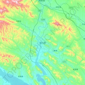
Name: Xichuan topographic map, elevation, terrain.
Location: Xichuan, Xichuan County, Nanyang City, Henan, China (32.97796 111.32205 33.29796 111.64205)
Average elevation: 1,073 ft
Minimum elevation: 472 ft
Maximum elevation: 3,166 ft
Thank you for supporting this site ❤️
Make a donation
Make a donation
Gear up for your next adventure:
As an Amazon Associate, this site earns from qualifying purchases at no extra cost to you.