
Jaro topographic map
Interactive map
Click on the map to display elevation.
About this map
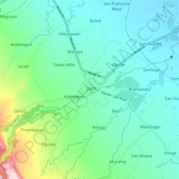
Name: Jaro topographic map, elevation, terrain.
Average elevation: 348 ft
Minimum elevation: 118 ft
Maximum elevation: 1,237 ft
Other topographic maps
Click on a map to view its topography, its elevation and its terrain.
Villa Conzoilo
Philippines > Leyte > Jaro
Villa Conzoilo, Jaro, 2nd District, Leyte, Eastern Visayas, 6527, Philippines
Average elevation: 1,345 ft
San Isidro
Philippines > Leyte > Jaro
San Isidro, Jaro, Leyte 2nd District, Leyte, Eastern Visayas, 6527, Philippines
Average elevation: 187 ft
Galotan
Philippines > Leyte > Jaro > Galotan
Galotan, Jaro, Leyte 2nd District, Leyte, Eastern Visayas, 6527, Philippines
Average elevation: 207 ft