
Westerstede topographic map
Interactive map
Click on the map to display elevation.
About this map
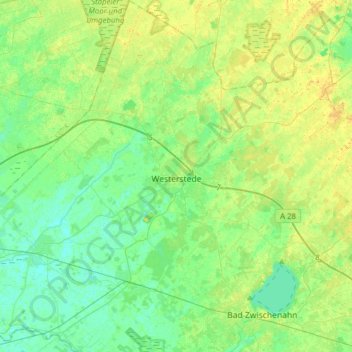
Name: Westerstede topographic map, elevation, terrain.
Location: Westerstede, Landkreis Ammerland, Lower Saxony, 26655, Germany (53.16527 7.79500 53.35190 8.06050)
Average elevation: 30 ft
Minimum elevation: 0 ft
Maximum elevation: 69 ft