
Gravere topographic map
Interactive map
Click on the map to display elevation.
About this map
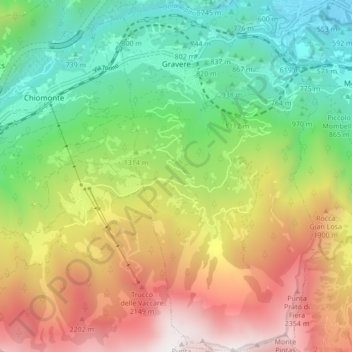
Name: Gravere topographic map, elevation, terrain.
Location: Gravere, TO, Piemont, Italy (45.07587 7.00402 45.13628 7.05340)
Average elevation: 4,570 ft
Minimum elevation: 1,591 ft
Maximum elevation: 8,776 ft