
Poio topographic map
Interactive map
Click on the map to display elevation.
About this map
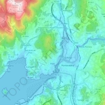
Name: Poio topographic map, elevation, terrain.
Location: Poio, Pontevedra, Galicia, España (42.40186 -8.76001 42.48190 -8.64980)
Average elevation: 338 ft
Minimum elevation: -7 ft
Maximum elevation: 1,991 ft
Other topographic maps
Click on a map to view its topography, its elevation and its terrain.
Raxó
España > Galicia > Pontevedra > Poio
Raxó, Poio, Pontevedra, Galicia, 36992, España
Average elevation: 197 ft