
Salto topographic map
Interactive map
Click on the map to display elevation.
About this map
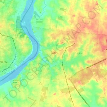
Name: Salto topographic map, elevation, terrain.
Location: Salto, 50000, Uruguai (-31.41614 -57.99652 -31.36290 -57.87881)
Average elevation: 112 ft
Minimum elevation: -10 ft
Maximum elevation: 243 ft