
Buria topographic map
Interactive map
Click on the map to display elevation.
About this map
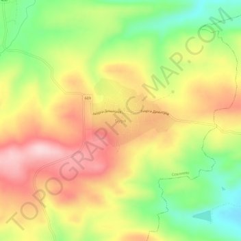
Name: Buria topographic map, elevation, terrain.
Location: Buria, Sevlievo, Gabrovo, Bulgaria (43.00772 25.29317 43.04772 25.33317)
Average elevation: 1,499 ft
Minimum elevation: 1,083 ft
Maximum elevation: 1,883 ft