
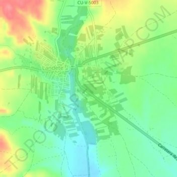
El Pilar topographic map
Interactive map
Click on the map to display elevation.
About this map
Name: El Pilar topographic map, elevation, terrain.
Location: El Pilar, Landete, Cuenca, Castilla-La Mancha, España (39.89437 -1.37172 39.91437 -1.35172)
Average elevation: 3,251 ft
Minimum elevation: 3,150 ft
Maximum elevation: 3,409 ft