
Estación Manuel topographic map
Interactive map
Click on the map to display elevation.
About this map
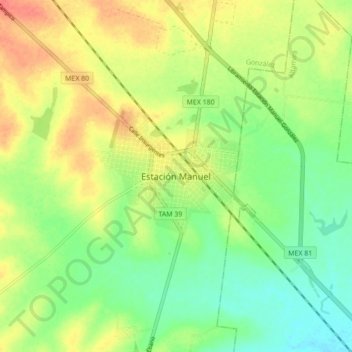
Name: Estación Manuel topographic map, elevation, terrain.
Location: Estación Manuel, González, Tamaulipas, México (22.68658 -98.35893 22.76658 -98.27893)
Average elevation: 240 ft
Minimum elevation: 157 ft
Maximum elevation: 338 ft
Other topographic maps
Click on a map to view its topography, its elevation and its terrain.
Cerro del Bernal
México > Tamaulipas > González
Cerro del Bernal, González, Tamaulipas, México
Average elevation: 1,027 ft