
Chaukori topographic map
Interactive map
Click on the map to display elevation.
About this map
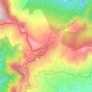
Name: Chaukori topographic map, elevation, terrain.
Location: Chaukori, Berinag, Pithoragarh, Uttarakhand, India (29.81863 80.01149 29.85863 80.05149)
Average elevation: 5,863 ft
Minimum elevation: 4,534 ft
Maximum elevation: 6,998 ft