
Ubľa topographic map
Interactive map
Click on the map to display elevation.
About this map
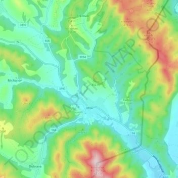
Name: Ubľa topographic map, elevation, terrain.
Average elevation: 1,017 ft
Minimum elevation: 630 ft
Maximum elevation: 1,913 ft
Other topographic maps
Click on a map to view its topography, its elevation and its terrain.
Ubľa
Slovakia > Region of Prešov > District of Snina > Ubľa
Ubľa, District of Snina, Region of Prešov, Eastern Slovakia, 067 73, Slovakia
Average elevation: 922 ft