Arc 2000 topographic map
Interactive map
Click on the map to display elevation.
About this map
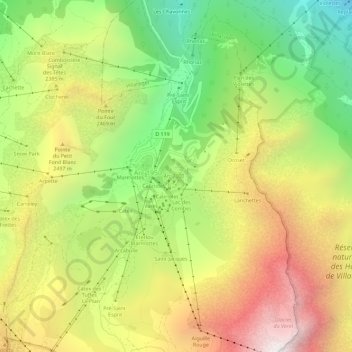
Name: Arc 2000 topographic map, elevation, terrain.
Average elevation: 7,402 ft
Minimum elevation: 4,587 ft
Maximum elevation: 10,541 ft

Click on the map to display elevation.
Name: Arc 2000 topographic map, elevation, terrain.
Average elevation: 7,402 ft
Minimum elevation: 4,587 ft
Maximum elevation: 10,541 ft