Geolocate

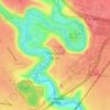
Launching Place topographic map

Click on the map to display elevation.

About this map

Name: Launching Place topographic map, elevation, terrain.

Location: Launching Place, Melbourne, Shire of Yarra Ranges, Victoria, 3139, Australia (-37.82457 145.53246 -37.73747 145.62283)

Average elevation: 531 ft

Minimum elevation: 259 ft

Maximum elevation: 2,008 ft

Other topographic maps

Click on a map to view its topography, its elevation and its terrain.
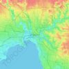
Melbourne

Australia > Victoria > Melbourne

Melbourne is also prone to isolated convective showers forming when a cold pool crosses the state, especially if there is considerable daytime heating. These showers are often heavy and can include hail, squalls, and significant drops in temperature, but they often pass through very quickly with a rapid…

Average elevation: 161 ft
Silvan Reservoir

Australia > Victoria > Melbourne

Average elevation: 886 ft

Brimbank Park

Australia > Victoria > Melbourne

Average elevation: 171 ft

Koomba Park

Australia > Victoria > Melbourne

Average elevation: 315 ft

Northgateway Reserve

Australia > Victoria > Melbourne

Average elevation: 236 ft

Burwood East

Australia > Victoria > Melbourne > Burwood East

Average elevation: 338 ft

Lincoln Square

Australia > Victoria > Melbourne > Carlton

Average elevation: 121 ft

Mothers Beach

Australia > Victoria > Melbourne

Average elevation: 30 ft

Gear up for your next adventure:

🛏️Cold Weather Sleeping Bag - Warm sleeping bag for cold conditions
🥘Titanium Cookware - Durable, featherlight pots and pans for backpacking
🛠️Backpacking Tool Kit - Essential toolkit for outdoor repairs
🪶Survival Guide Book - Expert advice for emergency preparedness
🖼️Topo Map Wall Art - Decorative topographic prints of famous peaks and regions

As an Amazon Associate, this site earns from qualifying purchases at no extra cost to you.