
Nopol Hill topographic map
Interactive map
Click on the map to display elevation.
About this map
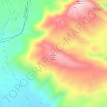
Name: Nopol Hill topographic map, elevation, terrain.
Average elevation: 1,407 ft
Minimum elevation: 787 ft
Maximum elevation: 2,028 ft
Other topographic maps
Click on a map to view its topography, its elevation and its terrain.
Siguel River
Philippines > South Cotabato > General Santos
Siguel River, General Santos, South Cotabato, Soccsksargen, Philippines
Average elevation: 1,821 ft
General Santos
Philippines > South Cotabato > General Santos
General Santos, South Cotabato, Soccsksargen, 9500, Philippines
Average elevation: 489 ft
Silway River
Philippines > South Cotabato > General Santos
Silway River, General Santos, South Cotabato, Soccsksargen, 9500, Philippines
Average elevation: 919 ft
Base Peak
Philippines > South Cotabato > General Santos
Base Peak, General Santos, South Cotabato, Soccsksargen, Philippines
Average elevation: 1,440 ft