
Bad Liebenstein topographic map
Interactive map
Click on the map to display elevation.
About this map
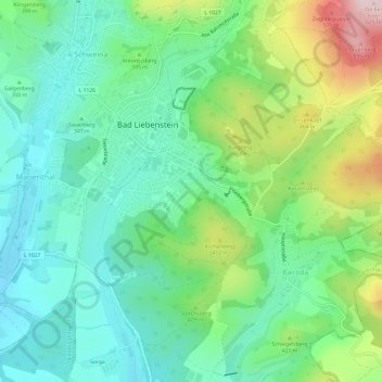
Name: Bad Liebenstein topographic map, elevation, terrain.
Location: Bad Liebenstein, Wartburgkreis, Thüringen, 36448, Deutschland (50.79273 10.33540 50.83076 10.39269)
Average elevation: 1,224 ft
Minimum elevation: 889 ft
Maximum elevation: 2,014 ft