
Beyşehir topographic map
Interactive map
Click on the map to display elevation.
About this map
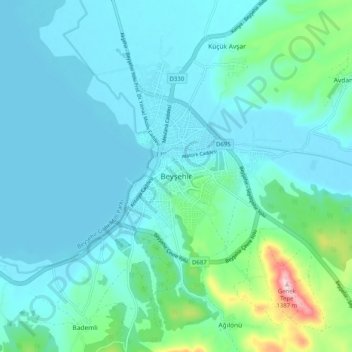
Name: Beyşehir topographic map, elevation, terrain.
Location: Beyşehir, Konya, İç Anadolu Bölgesi, Turquia (37.63545 31.68691 37.71545 31.76691)
Average elevation: 3,809 ft
Minimum elevation: 3,678 ft
Maximum elevation: 4,573 ft