
Mandi topographic map
Interactive map
Click on the map to display elevation.
About this map
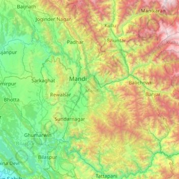
Name: Mandi topographic map, elevation, terrain.
Location: Mandi, Himachal Pradesh, India (31.23263 76.60605 32.07604 77.37726)
Average elevation: 5,279 ft
Minimum elevation: 994 ft
Maximum elevation: 17,129 ft