
Pralong topographic map
Interactive map
Click on the map to display elevation.
About this map
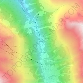
Name: Pralong topographic map, elevation, terrain.
Location: Pralong, Zinal, Anniviers, Sierre, Valais, 3961, Suisse (46.12931 7.60401 46.16931 7.64401)
Average elevation: 7,024 ft
Minimum elevation: 4,678 ft
Maximum elevation: 9,747 ft