
Intragna topographic map
Interactive map
Click on the map to display elevation.
About this map
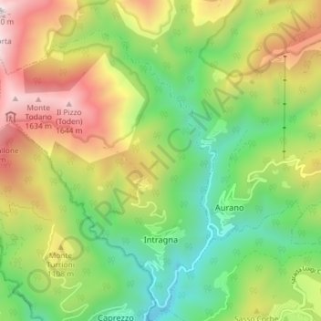
Name: Intragna topographic map, elevation, terrain.
Location: Intragna, VB, PIE, Itália (45.98152 8.52947 46.03141 8.58528)
Average elevation: 3,031 ft
Minimum elevation: 1,227 ft
Maximum elevation: 5,663 ft