
Ladeuze topographic map
Interactive map
Click on the map to display elevation.
About this map
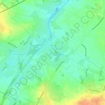
Name: Ladeuze topographic map, elevation, terrain.
Location: Ladeuze, Chièvres, Aat, Henegouwen, Wallonië, België (50.55043 3.73636 50.58110 3.78992)
Average elevation: 184 ft
Minimum elevation: 138 ft
Maximum elevation: 259 ft