
Strendur topographic map
Interactive map
Click on the map to display elevation.
About this map
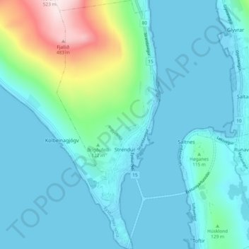
Name: Strendur topographic map, elevation, terrain.
Location: Strendur, Eysturoy region, 490, Faroe Islands (62.09011 -6.79116 62.13378 -6.75252)
Average elevation: 266 ft
Minimum elevation: -20 ft
Maximum elevation: 1,696 ft