
Gabaude topographic map
Interactive map
Click on the map to display elevation.
About this map
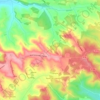
Name: Gabaude topographic map, elevation, terrain.
Location: Gabaude, Albi, Tarn, Occitanie, France métropolitaine, France (43.94028 1.83216 43.98028 1.87216)
Average elevation: 791 ft
Minimum elevation: 558 ft
Maximum elevation: 984 ft