
Alpi Liguri topographic map
Interactive map
Click on the map to display elevation.
About this map
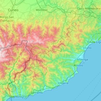
Name: Alpi Liguri topographic map, elevation, terrain.
Location: Alpi Liguri, Armo, Imperia, LIG, Italia (43.77569 7.48916 44.39467 8.45642)
Average elevation: 2,100 ft
Minimum elevation: 0 ft
Maximum elevation: 9,370 ft