
Abiegos topographic map
Interactive map
Click on the map to display elevation.
About this map
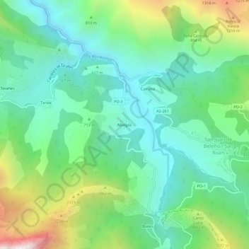
Name: Abiegos topographic map, elevation, terrain.
Location: Abiegos, Ponga, Asturies, 33557, Espagne (43.17444 -5.20609 43.21444 -5.16609)
Average elevation: 2,402 ft
Minimum elevation: 1,135 ft
Maximum elevation: 5,525 ft
Other topographic maps
Click on a map to view its topography, its elevation and its terrain.