
Crossgates topographic map
Interactive map
Click on the map to display elevation.
About this map
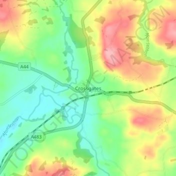
Name: Crossgates topographic map, elevation, terrain.
Location: Crossgates, Powys, Wales, LD1 6RD, United Kingdom (52.25529 -3.35728 52.29529 -3.31728)
Average elevation: 738 ft
Minimum elevation: 577 ft
Maximum elevation: 961 ft