
Kilclief Castle topographic map
Interactive map
Click on the map to display elevation.
About this map
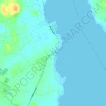
Name: Kilclief Castle topographic map, elevation, terrain.
Average elevation: 16 ft
Minimum elevation: -3 ft
Maximum elevation: 112 ft
Other topographic maps
Click on a map to view its topography, its elevation and its terrain.
Castle Ward
United Kingdom > Northern Ireland > Strangford
Castle Ward, Ballyculter Avenue, Strangford, Newry, Mourne and Down District Council, Northern Ireland, BT30 7LS, United Kingdom
Average elevation: 72 ft