
Uchtspringe topographic map
Interactive map
Click on the map to display elevation.
About this map
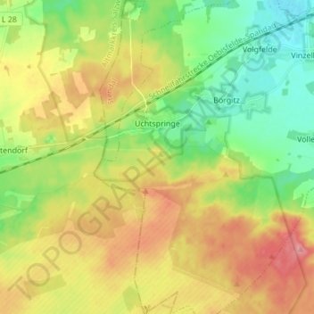
Name: Uchtspringe topographic map, elevation, terrain.
Location: Uchtspringe, Stendal, Sachsen-Anhalt, Deutschland (52.48785 11.56867 52.57105 11.63756)
Average elevation: 276 ft
Minimum elevation: 148 ft
Maximum elevation: 436 ft