Geolocate

Canguera topographic map

Click on the map to display elevation.

About this map
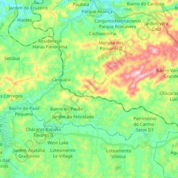
Name: Canguera topographic map, elevation, terrain.

Location: Canguera, São Roque, Região Imediata de Sorocaba, Região Metropolitana de Sorocaba, Região Geográfica Intermediária de Sorocaba, São Paulo, Southeast Region, Brazil (-23.65320 -47.20849 -23.57059 -47.05648)

Average elevation: 2,956 ft

Minimum elevation: 2,608 ft

Maximum elevation: 3,691 ft

Gear up for your next adventure:

🪑Ultralight Camp Chairs - Portable seating for resting after a long day of mapping
🗺️Topographic Maps - Detailed topo maps for hiking, exploring and outdoor navigation
🦶Carbon Trekking Poles - Reduce knee impact on steep descents with ultra-light poles
🕶️Glacier Sunglasses - Side shields to protect eyes from high-altitude snow glare
💧Water Filtration Bottles - Safely drink from streams and lakes while exploring

As an Amazon Associate, this site earns from qualifying purchases at no extra cost to you.