
Potosi topographic map
Interactive map
Click on the map to display elevation.
About this map
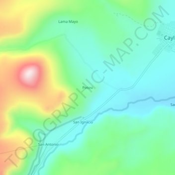
Name: Potosi topographic map, elevation, terrain.
Location: Potosi, Caylloma, Arequipa, Peru (-15.22002 -71.81386 -15.18002 -71.77386)
Average elevation: 14,560 ft
Minimum elevation: 14,055 ft
Maximum elevation: 15,751 ft