
Lõunaküla / Storbyn topographic map
Interactive map
Click on the map to display elevation.
About this map
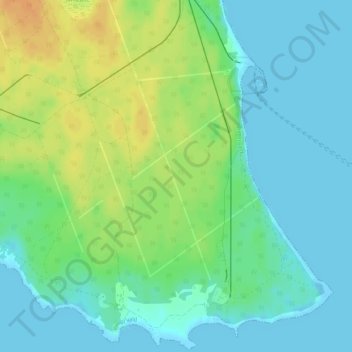
Name: Lõunaküla / Storbyn topographic map, elevation, terrain.
Average elevation: 39 ft
Minimum elevation: -3 ft
Maximum elevation: 102 ft
Other topographic maps
Click on a map to view its topography, its elevation and its terrain.
Tallinn
Tallinn, Stadtgemeinde Reval, Kreis Harrien, Estland
Average elevation: 52 ft
Lääne-Harju vald
Lääne-Harju vald, Kreis Harrien, Estland
Average elevation: 75 ft