
Kootenay National Park topographic map
Interactive map
Click on the map to display elevation.
About this map
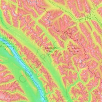
Name: Kootenay National Park topographic map, elevation, terrain.
Average elevation: 6,010 ft
Minimum elevation: 2,579 ft
Maximum elevation: 11,188 ft
L'altitude varie de 918 m à 3 424 m au sommet de la Deltaform Mountain. Le parc s'étend sur 1 406 km2.