
Ramble topographic map
Interactive map
Click on the map to display elevation.
About this map
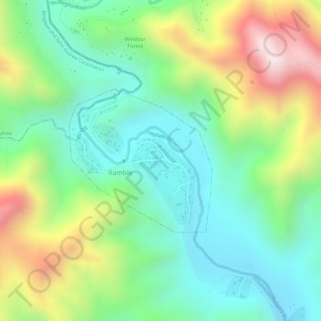
Name: Ramble topographic map, elevation, terrain.
Location: Ramble, Saint Thomas, Surrey County, Jamaica (17.97230 -76.62367 17.98436 -76.61107)
Average elevation: 1,191 ft
Minimum elevation: 538 ft
Maximum elevation: 2,313 ft