
Tatham topographic map
Interactive map
Click on the map to display elevation.
About this map
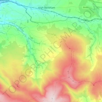
Name: Tatham topographic map, elevation, terrain.
Average elevation: 692 ft
Minimum elevation: 49 ft
Maximum elevation: 1,844 ft
Other topographic maps
Click on a map to view its topography, its elevation and its terrain.
Wennington
United Kingdom > England > Lancashire > Lancaster > Wennington
Wennington, Lancaster, Lancashire, England, United Kingdom
Average elevation: 233 ft