
Phan Rang–Tháp Chàm City topographic map
Interactive map
Click on the map to display elevation.
About this map
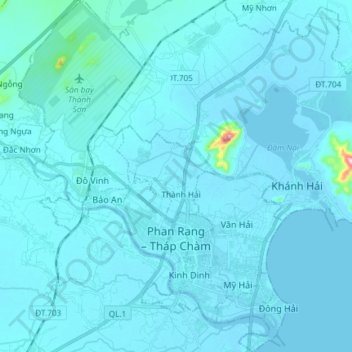
Name: Phan Rang–Tháp Chàm City topographic map, elevation, terrain.
Location: Phan Rang–Tháp Chàm City, Ninh Thuận Province, Vietnam (11.53009 108.91895 11.67519 109.03516)
Average elevation: 43 ft
Minimum elevation: -3 ft
Maximum elevation: 1,079 ft
Other topographic maps
Click on a map to view its topography, its elevation and its terrain.
Ninh Phước District
Ninh Phước District, Ninh Thuận Province, Vietnam
Average elevation: 394 ft
Ninh Sơn District
Ninh Sơn District, Ninh Thuan province, Vietnam
Average elevation: 1,270 ft
Thuận Nam District
Thuận Nam District, Ninh Thuan province, Vietnam
Average elevation: 492 ft
Phan Rang - Tháp Chàm
Vietnam > Ninh Thuan province > Phan Rang - Tháp Chàm
Phan Rang - Tháp Chàm, Phan Rang–Tháp Chàm, Ninh Thuan province, Vietnam
Average elevation: 213 ft