
Kadamtala topographic map
Interactive map
Click on the map to display elevation.
About this map
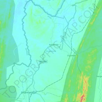
Name: Kadamtala topographic map, elevation, terrain.
Location: Kadamtala, North Tripura, Tripura, India (24.35715 92.10418 24.53088 92.27310)
Average elevation: 115 ft
Minimum elevation: 46 ft
Maximum elevation: 607 ft