
锁作乡 topographic map
Interactive map
Click on the map to display elevation.
About this map
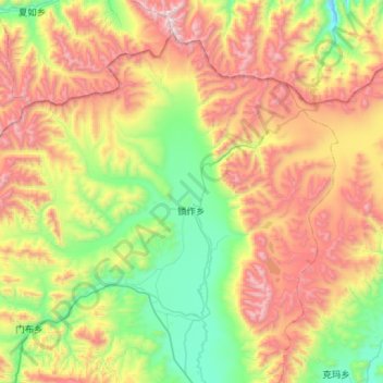
Name: 锁作乡 topographic map, elevation, terrain.
Location: 锁作乡, 聂拉木县, 日喀则市, 西藏自治区, 中国 (28.72381 86.04896 29.13805 86.61903)
Average elevation: 16,332 ft
Minimum elevation: 14,016 ft
Maximum elevation: 20,049 ft