
Ömerli Mahallesi topographic map
Interactive map
Click on the map to display elevation.
About this map
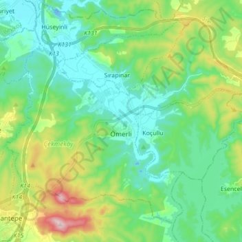
Name: Ömerli Mahallesi topographic map, elevation, terrain.
Location: Ömerli Mahallesi, Çekmeköy, Istanbul, Marmara Region, Turkey (41.03846 29.26562 41.12584 29.40203)
Average elevation: 335 ft
Minimum elevation: -39 ft
Maximum elevation: 1,263 ft
Other topographic maps
Click on a map to view its topography, its elevation and its terrain.