
Nadadouro topographic map
Interactive map
Click on the map to display elevation.
About this map
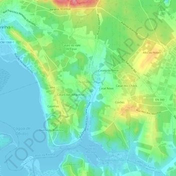
Name: Nadadouro topographic map, elevation, terrain.
Location: Nadadouro, Caldas da Rainha, Leiria, Oeste, Centre, Portugal (39.39882 -9.21932 39.43805 -9.16511)
Average elevation: 89 ft
Minimum elevation: -13 ft
Maximum elevation: 299 ft