
Fort Tejon State Historic Park topographic map
Interactive map
Click on the map to display elevation.
About this map
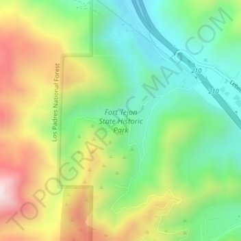
Name: Fort Tejon State Historic Park topographic map, elevation, terrain.
Average elevation: 3,839 ft
Minimum elevation: 3,022 ft
Maximum elevation: 5,098 ft
Other topographic maps
Click on a map to view its topography, its elevation and its terrain.
Lebec
USA > California > Lebec
Lebec, Ridge Route Drive, Lebec, Kern County, California, 93243, USA
Average elevation: 4,364 ft