Geolocate

Chappaqua topographic map

Click on the map to display elevation.

About this map
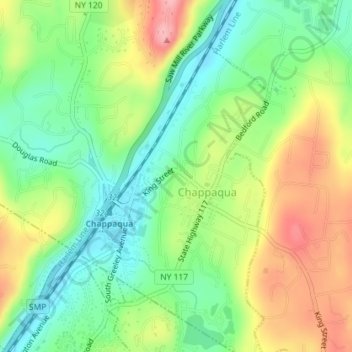
Name: Chappaqua topographic map, elevation, terrain.

Location: Chappaqua, Town of New Castle, Westchester County, New York, United States (41.14427 -73.77804 41.17068 -73.75587)

Average elevation: 489 ft

Minimum elevation: 305 ft

Maximum elevation: 692 ft

Westchester County trails, hiking, mountain biking, running and outdoor activities

Gear up for your next adventure:

⌚GPS Sports Watch - GPS watch for running, hiking and training
🪶Camping Sleeping Pad - Comfortable sleeping pad for backpacking
🎒Outdoor Daypacks - Lightweight backpacks designed for carrying maps and essential gear
📻Weather Alert Radios - Stay informed of storm risks while off-the-grid
📚USA Hiking Guide Books - Top trail guides and map books

As an Amazon Associate, this site earns from qualifying purchases at no extra cost to you.