Geolocate

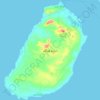
Hengam-e Jadid topographic map

Click on the map to display elevation.

About this map

Name: Hengam-e Jadid topographic map, elevation, terrain.

Location: Hengam-e Jadid, دهستان هنگام, بخش شهاب, Qeshm County, Hormozgan Province, Iran (26.67709 55.88561 26.68623 55.89679)

Average elevation: 30 ft

Minimum elevation: 0 ft

Maximum elevation: 335 ft

Other topographic maps

Click on a map to view its topography, its elevation and its terrain.
Gear up for your next adventure:

🔭Stargazing Telescopes - Perfect for camping in low-light pollution areas shown on maps
🔭Compact Binoculars - HD vision for scouting terrain and identifying distant landmarks
🪓Survival Multi‑Tool - Versatile tool for camp and trail tasks
🥘Titanium Cookware - Durable, featherlight pots and pans for backpacking
🛏️Cold Weather Sleeping Bag - Warm sleeping bag for cold conditions

As an Amazon Associate, this site earns from qualifying purchases at no extra cost to you.