
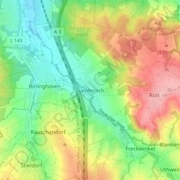
Dambroich topographic map
Interactive map
Click on the map to display elevation.
About this map
Name: Dambroich topographic map, elevation, terrain.
Average elevation: 404 ft
Minimum elevation: 223 ft
Maximum elevation: 643 ft
Der Ort liegt in einer Höhe von 80 bis 100 Metern über N.N. im Pleisbachtal. Nachbarorte sind Haus Oelgarten im Nordosten, Rott im Osten, Scheurenmühle im Süden und Birlinghoven im Westen.