
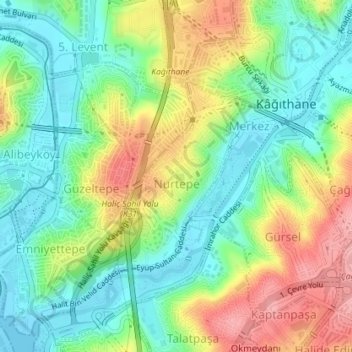
Nurtepe Mahallesi topographic map
Interactive map
Click on the map to display elevation.
About this map
Name: Nurtepe Mahallesi topographic map, elevation, terrain.
Location: Nurtepe Mahallesi, Kâğıthane, Istanbul, Marmara Region, Turkey (41.06810 28.95538 41.08297 28.96884)
Average elevation: 151 ft
Minimum elevation: -3 ft
Maximum elevation: 387 ft