
华墅乡 topographic map
Interactive map
Click on the map to display elevation.
About this map
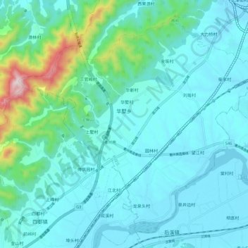
Name: 华墅乡 topographic map, elevation, terrain.
Location: 华墅乡, 柯城区, 衢州市, 浙江省, 中国 (28.83530 118.68131 28.91844 118.78948)
Average elevation: 538 ft
Minimum elevation: 220 ft
Maximum elevation: 2,392 ft
Other topographic maps
Click on a map to view its topography, its elevation and its terrain.