
Tetto Franda topographic map
Interactive map
Click on the map to display elevation.
About this map
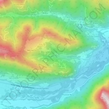
Name: Tetto Franda topographic map, elevation, terrain.
Location: Tetto Franda, Moiola, Coni, Piémont, 12010, Italie (44.30300 7.35338 44.34300 7.39338)
Average elevation: 2,920 ft
Minimum elevation: 2,149 ft
Maximum elevation: 4,626 ft