
Endingen topographic map
Interactive map
Click on the map to display elevation.
About this map
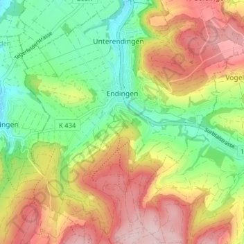
Name: Endingen topographic map, elevation, terrain.
Location: Endingen, Bezirk Zurzach, Argovie, 5304, Suisse (47.51073 8.26296 47.55423 8.32212)
Average elevation: 1,565 ft
Minimum elevation: 1,194 ft
Maximum elevation: 1,991 ft